VFR Pincher Creek to Cranbrook flightplan v1.0
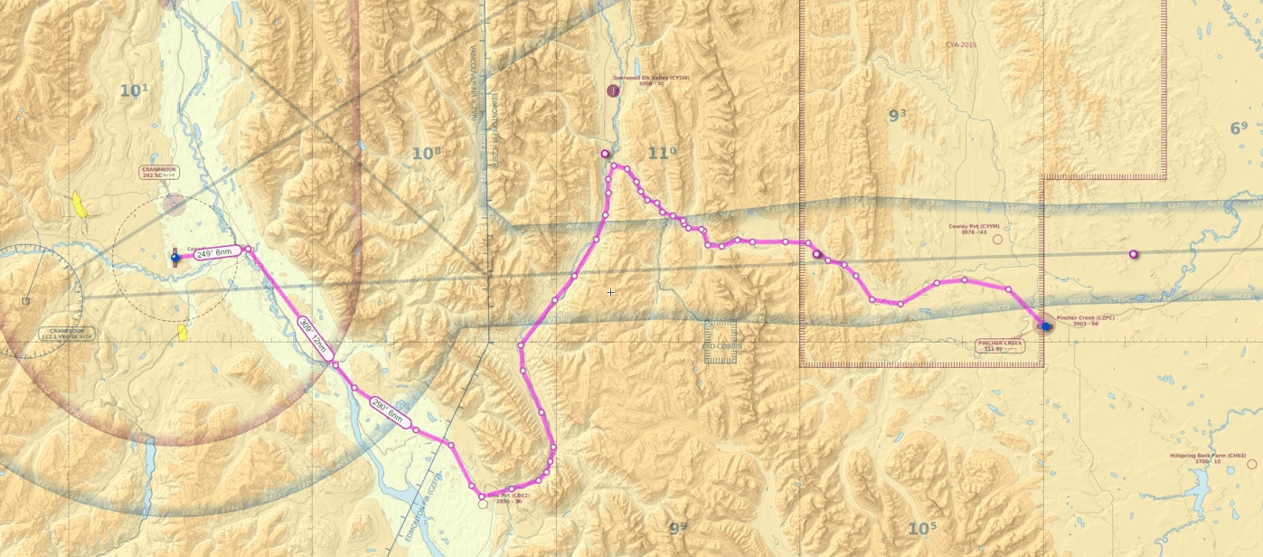
This is the published VFR route from Pincher Creek CZPC to Cranbrook CYXC. It will take you through the Crowsnest Pass along the Crowsnest River to Fernie, past the Frank slide, down to Elko and back up to Fort Steele along the Kootenay River before cutting over to Cranbrook.
Minimum safe enroute altitude 8500 westbound.
Trip distance 108 nm. Flight time about 1 hour in a Cessna 172.
The reverse flightplan is also included.


