LJSG – Slovenj Gradec & mount St.Ursula landmark, Slovenia v1.0
NOTE: This scenery is optimized for SLOVENIA 20m DEM by the almighty Troglodytus although it is fully compatible with the default scenery!
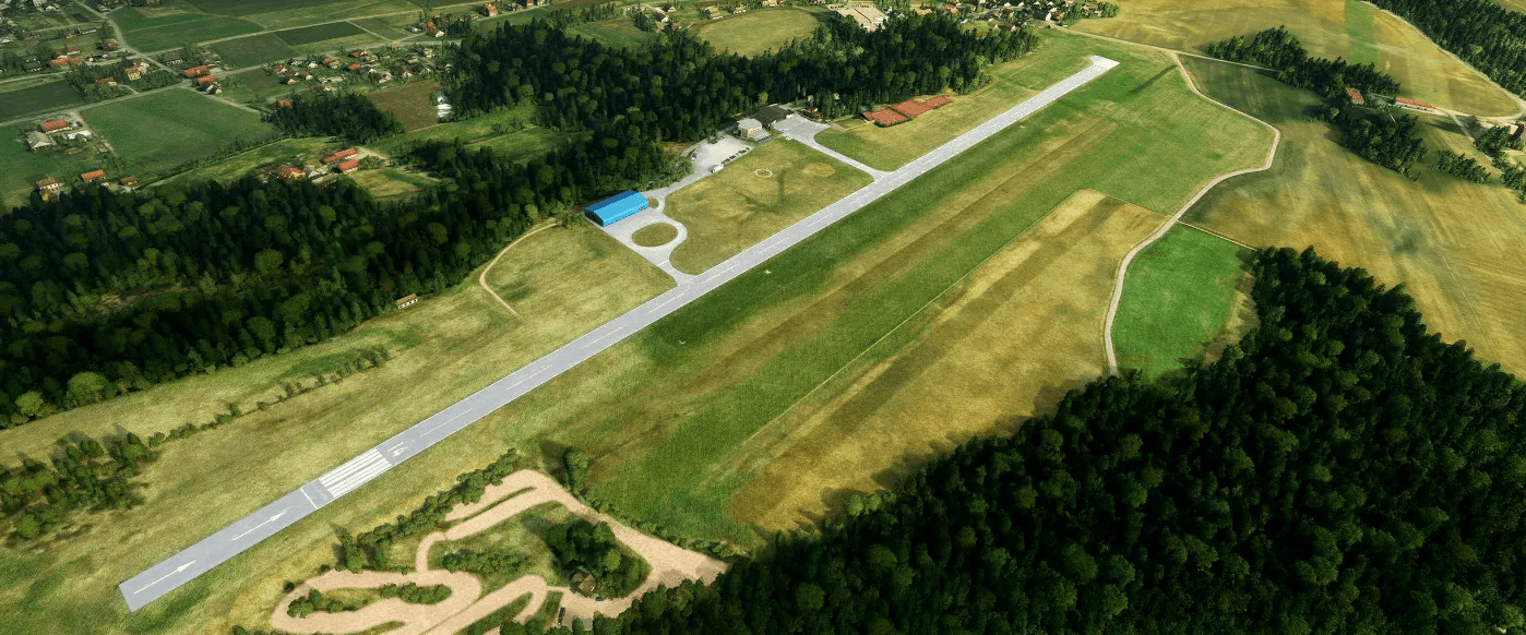
For my 4th project, I’ve recreated Slovenj Gradec airport (LJSG) and the Mount St. Ursula landmark.
The airport was established in 1957 when plans were laid down for building the facility as sport aviation activities, predating WW2 demanded the need for a proper site. In 1979 a concrete runway was constructed and in 2002 the airport recieved a complete refit, including a new hangar, new tourist facilities and infrastructure. The location includes a small tourist village with tennis yards and recreational faclities. During its lifetime, the airport has hosted many activities, ranging from gliding, sport, acrobatic and commercial GA. Nowaday the airport is seeking new ownership although the club continues to operate in limited capabilities.
Additionally, this package also contains the landmark of Mount St. Ursula (Uršlja Gora) located 11km (6nm) West of the airport at an altitude of 1699m (5547ft) . Below the peak stands the Gothic St. Ursula’s Church (which gives the mountain its name and is the highest-standing church in Slovenia), a TV mast tower, a mountain lodge (the Mount St. Ursula Lodge, Dom na Uršlji gori) all hand modelled for a complete landmark POI fly trip.
Features:
runways: – 14/32, 3,930ft, 1,200m, asphalt
– 14/32, 2000ft, 620m grass
Elevation AMSL – 500 m / 1,640 ft
Custom handcrafted objects using real world references
Real world taxiways and parking decals
Reworked grass, taxiways, and runways.
Custom glider trailers, tons of assets, and details
Animated flags following wind direction and 4 states of wind strength (by mamu)
Landmark scenery POI, with custom objects and terraforming included (Mount St.Ursula)
Installation:
Unzip the download and drag&drop the folder into your community folder!
A big thanks goes to Dušan, he is the main contributor for all high resolution photos used in the project. Online references were used too. The build was tested and reviewed for VR with good fps results (i7 8700, rtx3080, 32Gb, Reverb G2).
By request, the scenery also includes a memorial to a person who recently passed away and his go to aircraft stationed at this location. He was a close relative to Aichi also a livery creator, check out his work.
Thanks!
GPS Coordinates: 46.472869, 15.116007



![Beirut–Rafic Hariri International Airport – OLBA [LIGHTS ADDED] v0.5](https://www.allflightmods.com/wp-content/uploads/2021/07/Beirut–Rafic-Hariri-International-Airport-OLBA-LIGHTS-ADDED-v0.5-520x245.png)