Swiss High Altitude Strips v0.1
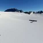
When others go backcountry flying the swiss go glacier flying. There are roughly 25 official glacier landing sites that even have their own ICAO codes.
The strips in the package are excessively simple, they consist of:
One or more runways with terraforming (from GIS-data) to smooth the mesh
Two parkings as spawn points
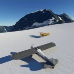
A parked yellow cub at the highest point of the runway – next to the runway and facing it (90°). These are the only visual reference for locating the strips.
This is a somewhat experimental concept – let me know what you think of it. And whether it’s worth doing more.
List of Strips:
LSVD Clariden-Hüfifirn
LSVK Glärnischfirn
LSYI Limmerenfirn
Instuctions:
Installation: Just unpack the zip in the community folder.
Land uphill, take off downhill
One of the runways on Hüfifirn can be used in both directions
Bring a cub…
Limitations:
The glaciers seem to be recognised as sand. There’s even some grass growing on some of them. Adding 30cm of snow in the weather settings improves things
Terraforming artefacts (kinks) at the ends of runways. Once again we’ll just have to wait for better tools and/or better mesh data
The current low resolution mesh is not really up to the job
The parked yellow cub is sometimes wings level, sometimes wings properly parallel
you will just have to imagine skis


![Point Roberts Airpark – [1RL] v0.1](https://www.allflightmods.com/wp-content/uploads/2020/10/Point-Roberts-Airpark-1RL-v0.1-4-520x245.jpg)
