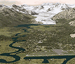
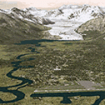
FS2004 LOD10 (38-m) Terrain Mesh of Glacier Bay National Park, Alaska
FS2004 LOD10 (38-m) Terrain Mesh of Glacier Bay National Park, Alaska This LOD10 (38-m) add-on mesh of Glacier Bay National Park and the adjacent Lynn Canal area between Juneau and Skagway (N58-60 W134-138) is an optional (!) upgrade of gl_bay_1.zip (by Holger Sandmann and Jim Keir). It adds more detail to the mountainous areas and allows to locally override other installed Alaska add-on meshes without having to deactivate them. The USGS NED seamless digital elevation data used for this mesh have a 2-arcsec (~60-m) resolution. Thus, the compilation as LOD10 (38-m) will reveal all terrain details contained in the source data. Please read the gl_bay_1.zip read-me file for further information about the special features of the Glacier Bay Project. By Holger Sandmann. 10.6MB

