Dunhuang Mogao International Airport (IATA: DNH, ICAO: ZLDH) v0.1.0
Dunhuang Mogao International Airport (IATA: DNH, ICAO: ZLDH) ver 0.1.0
IMPORTANT NOTE!!!
Since the airport building model corresponding to reality and the actual airport details are not used, this airport module plug-in is not a realistic restoration.
This scenery enhancement is free and is not to be sold!
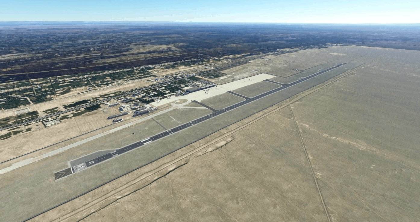
Dunhuang Mogao International Airport (IATA: DNH, ICAO: ZLDH)
Dunhuang Mogao International Airport is an airport serving the city of Dunhuang in Gansu Province, China. The airport was formerly known as Dunhuang Airport until June 2020.
– Airport type Public
– Serves Dunhuang, Gansu
– Location Mogao, Dunhuang
– Coordinates 40°09′40″N 94°48′33″E
– Simplified Chinese 敦煌莫高国际机场
Installation instructions
Extract ZIP file and place folder (jed studio-dunhuang-zldh-aerial, jed studio-dunhuang-zldh-airport, jed studio-dunhuang-zldh-materials) into your Community Folder
Version 0.1.0
Main features
– Detailed satellite imagery surrounding the airport. Not Color matching aerial imagery with Default MFS.
– 3400×45 meters Runway 08-26. New runway matches the default runway position,has 2-3 meters offset.
– Terminal 1-2-3,Arpon and texiway as AERODROME CHART.
– Sloped runway. RWY08 1124.7m,RWY26 1118.9m.
– Default MFS2020 dynamic landing, runway, apron and taxiway lighting.
– Default MFS2020 dynamic jetways.
– Default MFS2020 models.
Navaids
ILS RWY08 (IMG), GS
Frequency: 109.30 MHz
Magnetic declination: 0.6° East
Has Backcourse
Localizer Heading: 83°M
Glideslope Pitch: 3.0°
ILS RWY26 (IDH), GS
Frequency: 108.70 MHz
Magnetic declination: 0.6° East
Has Backcourse
Localizer Heading: 263°M
Glideslope Pitch: 3.0°
Current bugs
– ILS is incorrect as CHART;
– ILS rwy08 has an offset;
– Not change Navaids Default MFS2020( Waypoint、VORDME);
GPS Coordinates: 40.161111, 94.809167


![[UNUSABLE / LOOKING FOR DEV] EDDK Enhanced v0.1](https://www.allflightmods.com/wp-content/uploads/2020/11/UNUSABLE-LOOKING-FOR-DEV-EDDK-Enhanced-v0.1-520x245.jpg)
