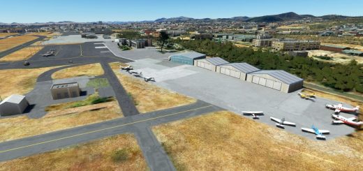
Flugplatz Agathazell [EDDO] v1.0
Agathazell airfield is a gliding site located only 800 meters east of the outskirts of Immenstadt and just under 2.5 km north of the town of Sonthofen in the municipality of Burgberg. It is the southernmost flying field in Germany.
The airfield and the buildings are operated by the Luftsportgemeinschaft Oberallgäu e.V.. The stationed aircraft are owned by the Luftsportverein Agathazell e.V. The two clubs have 162 members, of which 61 are active (as of March 2017).
(Source: Wikipedia)
Description:
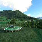
This is my first self-made scenery. The airfield area was extended by some fictional elements. Like the illuminated helipad (Where you can land after a nice helicopter sightseeing flight in the Allgäu Alps).
Dependencies:
You need the Mikea.at AssetPack!
Installation instructions:
Copy unzipped ZIP file in the community folder.
Credits:
Many thanks to GBZH35 for the Helipad Asset & to Mikea.at
GPS Coordinates: 47.55339125688655, 10.272463498197883

![Flugplatz Agathazell [EDDO] v1.0](https://www.allflightmods.com/wp-content/uploads/2021/11/Flugplatz-Agathazell-EDDO-v1-2.png)
