RAF Chivenor – UK – EGDC – Tag21 v1.0
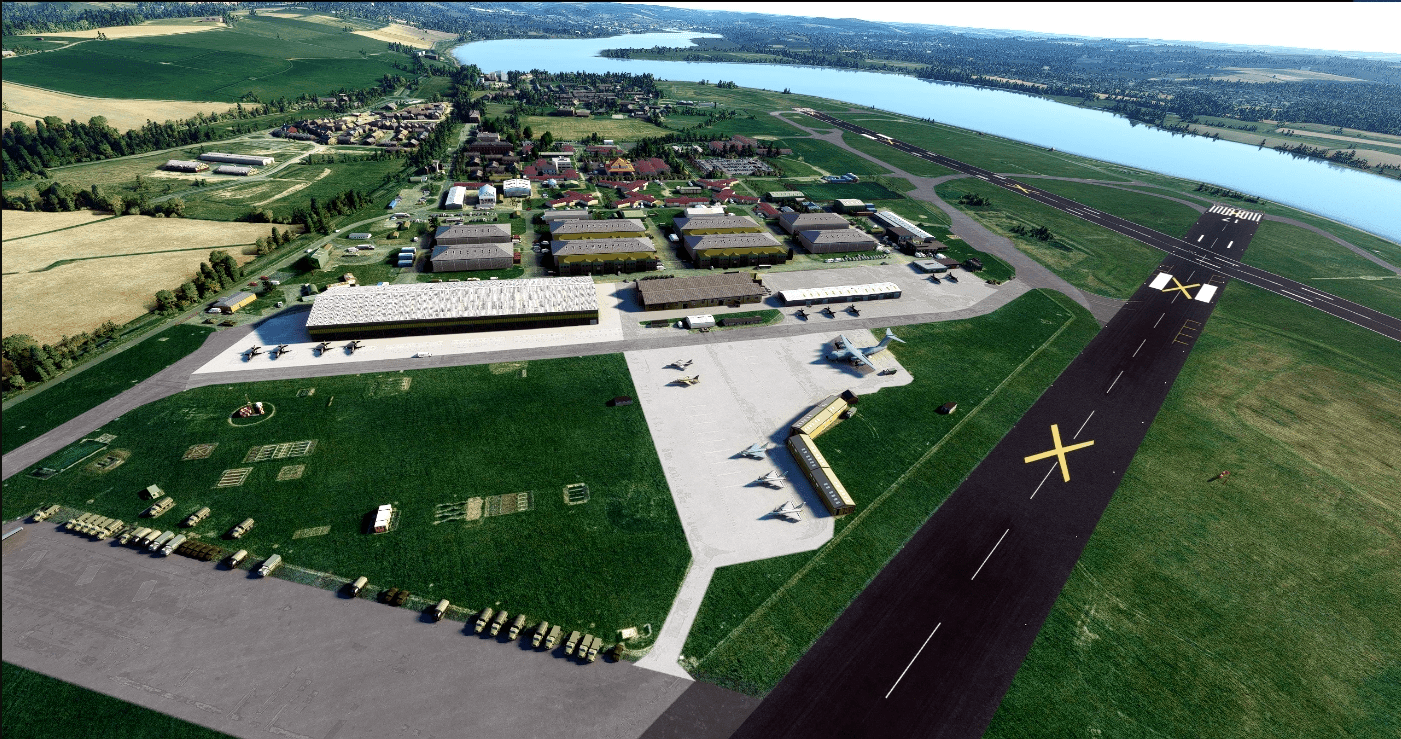
RAF Chivenor (ICAO: EGDC) was a Royal Air Force station located on the northern shore of the River Taw estuary, on the north coast of Devon, England. The nearest towns are Barnstaple and Braunton.
Originally a civil airfield opened in the 1930s, the site was taken over by the Royal Air Force in May 1940 for use as a Coastal Command Station. After World War II, the station was largely used for training, particularly weapons training. During the 1950s and 1960s, No. 229 Operational Conversion Unit used Hawker Hunter aircraft for training. In 1974 the station was left on “care and maintenance”, though No. 624 Volunteer Gliding Squadron (624 VGS) continued to fly from there. The RAF returned in 1979, forming 2 Tactical Weapons Unit (2 TWU) which flew BAE Hawks, from 1979 until the unit was renamed as No. 7 Flying Training School RAF in 1992. In 1994, 7 FTS left Chivenor, merging with No. 4 Flying Training School RAF at RAF Valley, and the airfield was handed over to the Royal Marines and the base was re-named as Royal Marines Base Chivenor.
To see all the objects you will need all the Asobo airfields, plus the Library files I identify in the screenshots.
To install the scenery, just place the scenery file into your Community folder.
When editing in the SDK the runways were showing as normal, but on compiling the scenery, the closed runway crosses have appeared. Not sure why that is.
Perhaps BigGazza can produce a 151 Sqn Hawk skin to use at the base.
Well you could buy me a coffee
GPS Coordinates: 51.088127, -4.149972


![[Fictional] EHBA-Breda v1.0](https://www.allflightmods.com/wp-content/uploads/2021/03/Fictional-EHBA-Breda-v1-2-520x245.png)


