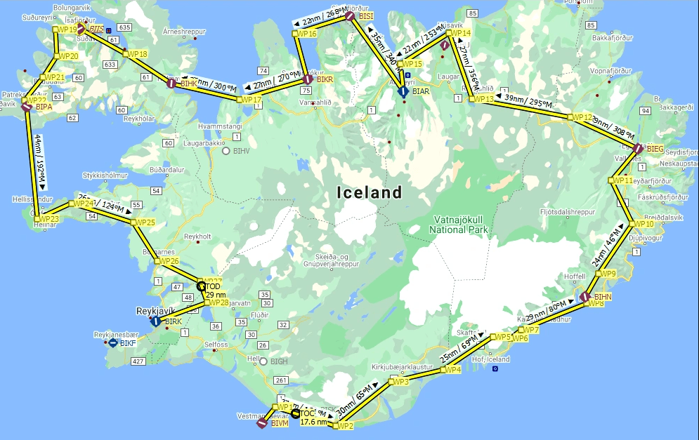
Discover Iceland Bush Trip Flight Plan v1.0
This is a Little Navmap flight plan for the Discover Iceland Bush Trip that is part of Microsoft Flight Simulator FS2020 World Update V.
I prefer to do these trips in a more relaxed fashion so I can use the drone to scout ahead and explore the points of interest along the route.
Load this flight plan into Little Navmap and turn on the autopilot on the Cessna Grand Caravan. Use the autopilot to fly to each waypoint. You will need to climb to approx. 7500ft when flying over the highest point in Iceland.
I also like to look up the places on Google Maps and view the photos that people have taken. You can use the drone to match up the viewpoint in the photos and see how well the landmarks are represented in FS2020.
Enjoy!


![[Ground Handling] Emirates Textures v1.0](https://www.allflightmods.com/wp-content/uploads/2020/12/Ground-Handling-Emirates-Textures-v1.0-520x245.jpg)


