Hunter Valley flight plan v1.0
This flight plan takes in the main towns and cities of the Hunter Region (also known as Hunter Valley) in the Australian state of New South Wales.
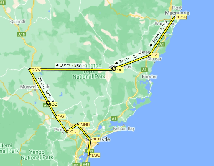
We depart from Port Macquarie Airport in the north and work our way inland (west) before returning to the coast just south of Newcastle and the mouth of the Hunter River on Lake Macquarie. The flight plan (included in both .pln and .lnmpln formats) is 223 nautical miles and took about 2.5 hours in the CubCrafters xCub. The longest stretch without landing (between Taree and Scone) takes us over Barrington Tops National Park. The areas around Singleton, Pokolbin and Cessnock are in the Hunter Region’s “wine country”.
The full route: Port Macquarie (YPMO) -> Taree (YTRE) -> Gloucester (YGCR) -> Scone (YSCO) -> Singleton (YSGT) -> Cessnock (YCNK) -> Maitland (YMND) -> Elermore Vale (YELR) -> Aeropelican (YLMQ).
To load the flight plan in the sim, navigate to the .pln from the load/save option on the World Map screen. If you want to follow along in Little Navmap, the other file is also for you.

