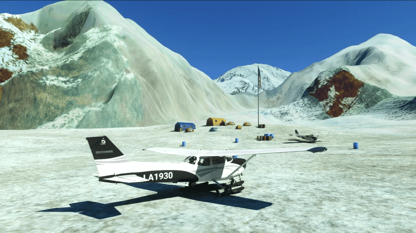
SEFB Denali Base Camp, South East Fork Base, Kahiltna Glacier, Alaska, USA. (New Scenery) v1.0
New scenery for SEFB Denali Base Camp Airstrip, South East Fork Base, Kahiltna Glacier, Alaska, USA.
This New scenery was requested, so here it is. Based on images & information from online.
Formerly Mt. McKinley
Located around 7,200 ft elevation ASL, on the Southeast Fork of the Kahiltna Glacier, it is the base camp for mountain climbers to start their ascent of Denali (elevation approx 20,320 ft) in Alaska. Travel to this base camp is typically conducted via small turboprop (Turbo-Otter and Porter) from Talkeetna, AK (PATK). There are four other camps on the ascent of Denali, Camp 1 at 7800 ft, Camp 2 at 11,200 ft, Camp 3 at 14,200 ft and the High Camp at 17,200 ft. , 63.078766, -151.053906. Summit at 20194ft. , 63.069000, -151.006300.
High Camp 17,200 ft & Summit 20194ft PIO will be added to Scenery at next update.
“SEFB Denali Base Camp Airstrip” msfs in game map ident
Put on your Ski’s!
All original msfs models etc used.
Installation – After unzipping, place the complete “sac-airport-sefb-denali-base-camp-airstrip” folder
into your MSFS community folder.
Thats it, Enjoy.
Any suggestions/errors for the scenery please say so, ask or comment.
Thankyou to all who enjoy these free downloads, its fun making them.
If you like them please comment & give a star rating.
Thirsty Work!
If you feel you would like to buy me a coffee, use the “PayPal me” button below.
Many Thanks.
GPS Coordinates: 62.970200, -151.162900

