Groningen – Kempkensberg Euroborg Mesdagkliniek v1.0
Photogrammetry data from Google Earth decoder to MSFS 2020.
This is my first project so if something is wrong please let me know!
The data includes landmarks as:
Kempkensberg, Mesdagkliniek, Euroborg, Stoker, Brander.
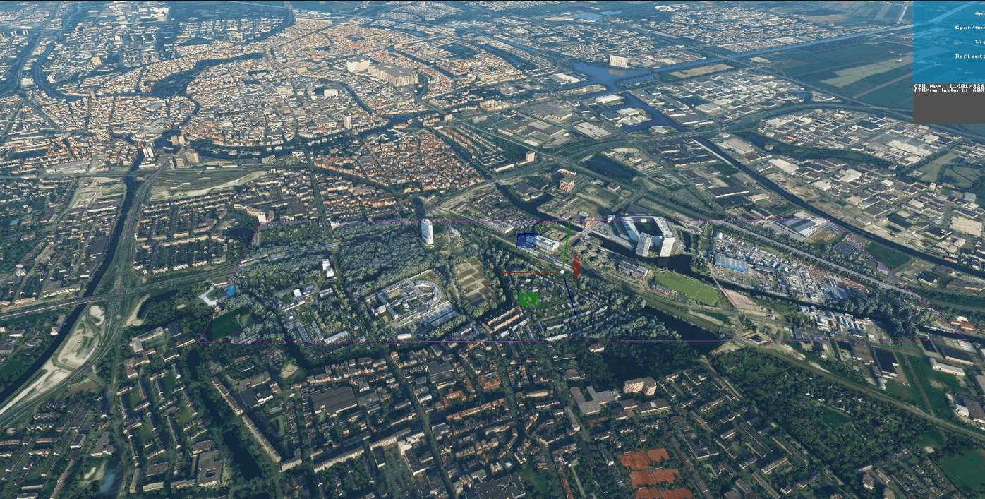
See attached picture for the exact area covered.
I will try to upload more scenery data very soon! (I will start with Groningen as this is all hobby and it’s my birthtown)
Have fun!
GPS Coordinates: 53.20429770311502, 6.585006208730576


