Paro Valley Landmarks v1.0
This pack adds certain POIs to Paro Valley, which are helpful for those who want to try a full flight to/from Paro Airport, rather than just playing with the Paro Landing Challenge (but passing the challenge is essential before a full flight).
From the AIP of Bhutan, these two points about Paro Airport are specified:
Entry/Exit into circuit area is via Chhuzom (confluence of rivers Paro Thimphu)
Avoid flying over dzongs, monastery or temples
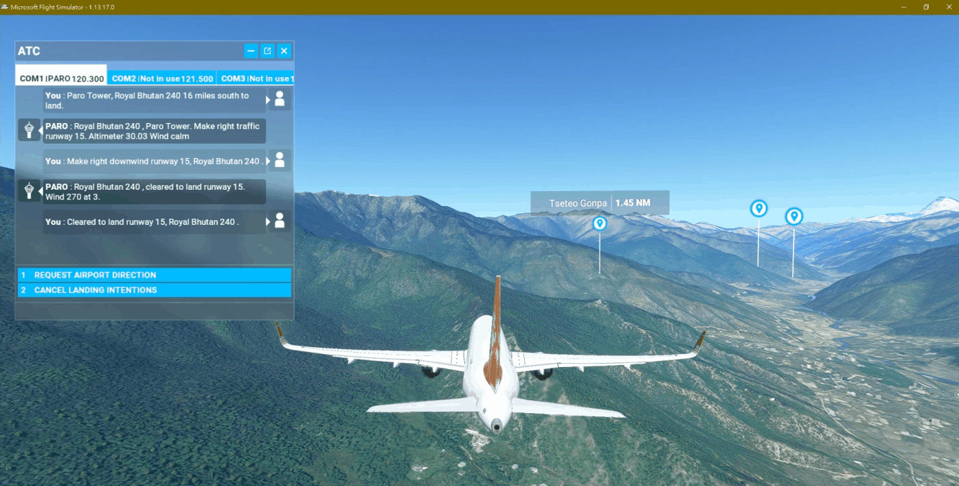
So what I have done is to add the corresponding POIs on Chhuzom and the religious buildings around Paro Valley. In fact most of these buildings are located on hillsides so it is not likely to fly over them directly. The largest one among them is the Rinpung Dzong (also called Paro Dzong), which is already handcrafted in stock scenery and you should see it clearly. In additional, I’ve also placed a POI on Mr. Smith’s House, which is the “target” for approaching runway 15.
For a full approach to Paro Airport visually, you may start with TAKTI or PR777, fly along the valley ahead. When you see the POI for Chhuzom and the river valley split into 2 directions, turn into the left one, and descend if you are assigned with runway 33. You may also follow the instrument cloud break procedure, but you will need to make U-turns for 2 times in Paro Valley in case for runway 33. I have placed a “real” VOR antenna object at the exact location of “PRO” VOR, but don’t try to fly too low for observing it.
Let’s continue with runway 15 approach. Fly near the hillside on the left, descend to about 10000 feets, and make a sharp U-turn (with bank angle of no less than 30 degrees) JUST after passing through Tseteo Gonpa on your starboard side, until you have Rinpung Dzong in sight again. When you stabilize the aircraft again, fly near the hillside on the right gradually, keep speed below 140KIAS with full flap, and fly over Mr. Smith’s House, with ground clearence of no more than 500 feets. You will now see the runway ahead, then it’s your skill to line-up quickly and touchdown.
For longer flights into Paro, it is often to have a stop at Guwahati Airport to confirm the weather at Paro before heading for it. I hope this mod would help you to get familiar with the landscape nearby.
*The procedures above are practiced for simulations ONLY. DO NOT TRY THIS IN REAL LIFE. Dedicated rating is required for flying into Paro in fact*
GPS Coordinates: 27.42883289366795, 89.42132549026286

