PilotPathRecorder v1.3.0
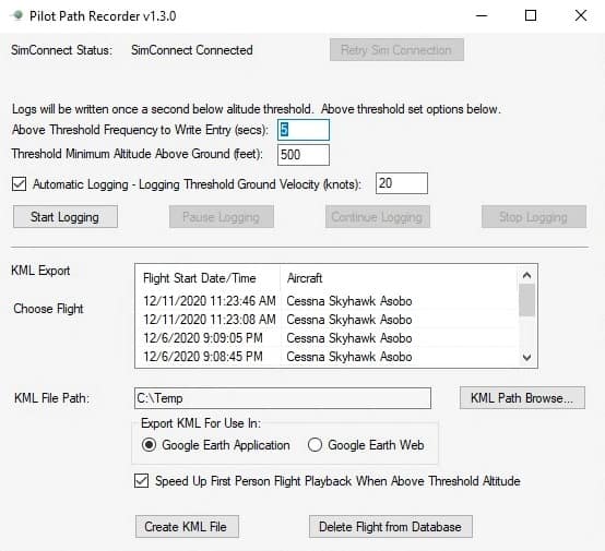
PilotPathRecorder is a replay and flight data capture tool that allows you to see your flight information visually using Google Earth. Simply use the application to log your flight and export that data to a KML file. That file can then be used with Google Earth for 3-dimensional flight analysis, flight plan information, and a chance to replay your flight from the first-person perspective. Detailed information is also available throughout your flight, such as speed, altitude, flap position, engine rpm, pitch, roll temperature, wind, flaps, lights, and much more.
This is a stand-alone application that is run outside of Microsft Flight Simulator 2020. Once run, this application allows the user to set various settings to control the recording and exporting experience. A database is used to store your flights so feel free to fly during one session and export in another.
Installation is easy. Unzip to any location you wish. Once unzipped, launch Flight Simulator and then the FS2020PlanePath.exe to start the application.

