Yosemite Valley v1.0
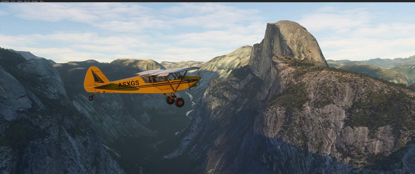
I am happy to present my initial release or Yosemite Valley. Its one of my favorite places on earth so I was really excited to see it well represented in the sim. As soon as I saw the first post describing how to work in google map data, I knew I wanted to do this. I’ve incorporated as much of the detailed geo available in google maps and worked hard to blend them into the existing landscape and color correct them to match as much as possible. All of the major features of the valley are well represented in their data – El Capitan, Half Dome, Glacier Point, Bridalveil Falls, Yosemite Falls, Vernal & Nevada Falls. Especially with the waterfalls I zoomed in for maximum detail and blended those into the surrounding geo.
I consider this just an “initial release”. There are several things I hope to tackle in the future, some that just require time, and others that need more from the SDK.
Future work includes:
– Creating normal maps to add finer detail when viewing objects from a closer distance
– Subdividing some areas of the geo and smoothing out some of the weird jagged shapes photogrammetry sometimes creates
– Get the FX system working from Asobo to add working waterfalls
– Get the animal SDK details to add some wandering around the park… (that said, there IS some stationary wildlife if you look very carefully)
– Do more paintwork to reduce the “baked in shadows” on some of the cliff faces from the photomapping
My other pet peeve is the hard shelled photogrammetry trees. I tried to preserve the MSFS trees from the landscape as much as possible. One thing Asobo needs to add is a “decal mode” that allows you to define a polygon projected onto an object that can also accept their vegetation shader. Right now you can only do that with polygons that lay flat on the base terrain mesh. So forgive the hard shell trees I had to leave where my surface didn’t match the ground. Hopefully we’ll get the ability to fix that in the future.
The other BIG CAVEAT…
I built this with my system in mind and wanted to get as much detail as I could. I do have a pretty beefy system (I9-9820X, 2080Ti 12G, 128G RAM, several 2TB SSDs). That said, I can get a pretty steady 40-45fps flying around in the worst areas. I have no idea how this will work on other systems. Please … be kind .. and let me know. I could be convinced to work on a lower res version with smaller textures and a step or two of geo simplifying in Blender.






found a few isasues
yes it looks better, but close up you really can see the outline of the polygons.
secondly, there arent any colliders on the cliffs. i enjoied spot landing on el capitan and half dome, but now i fly str8 through the terrain.
This was one of the first places I flew to when I got the game. Its one of my favorite places in the world. The default already looked really good, especially compared to anything we ever had in any flight sim before. But with this addon it looks incredible. I was able to use the drone camera to walk around on the ground where you get the ambient noise of woods and birds and animals and waterfalls and its almost like being there, especially at sunset. I don’t think most things in flight sim 2020 are supposed to look perfect at ground level or really close. But a few hundred feet above or at ground level thousands of feet below it looks amazing. Thank you very much for this! I will fly there even more now.